


CERT Surveyor app for iPhone and iPad
Developer: Andrew Olvera
First release : 18 Jan 2018
App size: 29.38 Mb
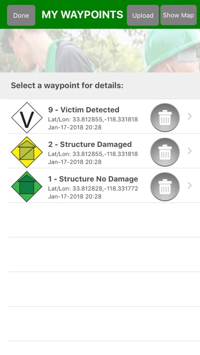
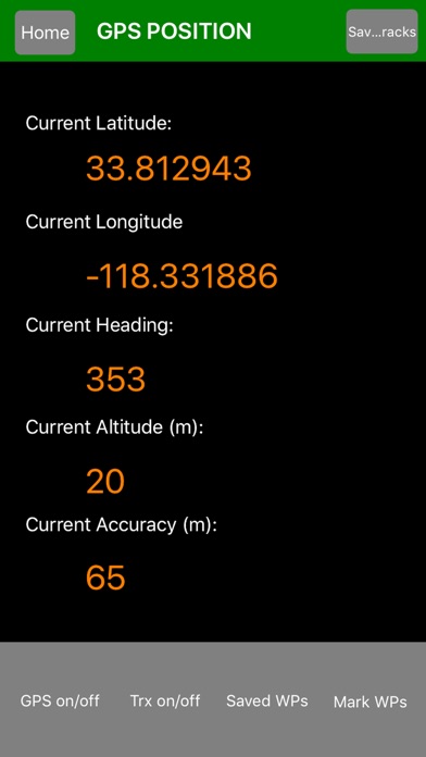
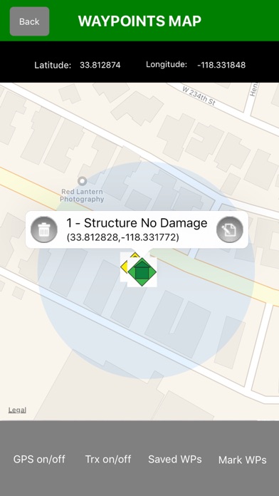
CERT Surveyor is designed by and for community emergency first responders for collecting information to help coordinate search and rescue operations. The app uses NAPSG USAR v7 FEMA CERT icons for dropping waypoints on a map; allows creating tracks at variable intervals and distance deltas; and loads pdfs maps as well as create maps with waypoint icons. All data can be uploaded to the accompanying website account and for data download as KML, GPX, and Excel file formats and for posting to your ArcGIS Online Operations Dashboard and more.
IMPORTANT NOTE: The Wifi only iPad does not have a dedicated Assisted GPS chip. The Wifi + Cellular version has the chip, but in the event of no Wifi signals and no Data signal areas (open ocean, high desert, steel/heavy concrete buildings), the GPS feature may not work. We recommend adding a dedicated GPS attachment for these purposes.
TEAM MANAGERS/LEADERS: Please contact [email protected] to have your CERT Surveyor account upgraded for free to a Team Admin for managing your team members (who have signed up with the same team code) on the website at https://cert.disastersurveyor.com.